The Zion-Mount Carmel Highway is open to through traffic by day, and closed on UDOT’s construction nights. From 9 p.m. to 6 a.m. on those nights nothing gets through between Canyon Junction and the tunnel’s east end: UDOT set the first week of them for 26 to 30 October 2026, and its project page sets the second for 2 to 6 November (the details are below). The road had been closed between Canyon Junction and the East Entrance from 30 September, after a large rockfall damaged it, and the Park Service reopened it on Friday 9 October. The park set 26 to 30 October to repave the damaged stretch, east of Canyon Junction at the first switchback, with one-way traffic and minor delays for the work. While it was shut, Zion Canyon and everything east of it, Mount Carmel Junction, Kanab and Bryce Canyon, were a drive of two hours or more around the outside of the park. The Scenic Drive was never affected.
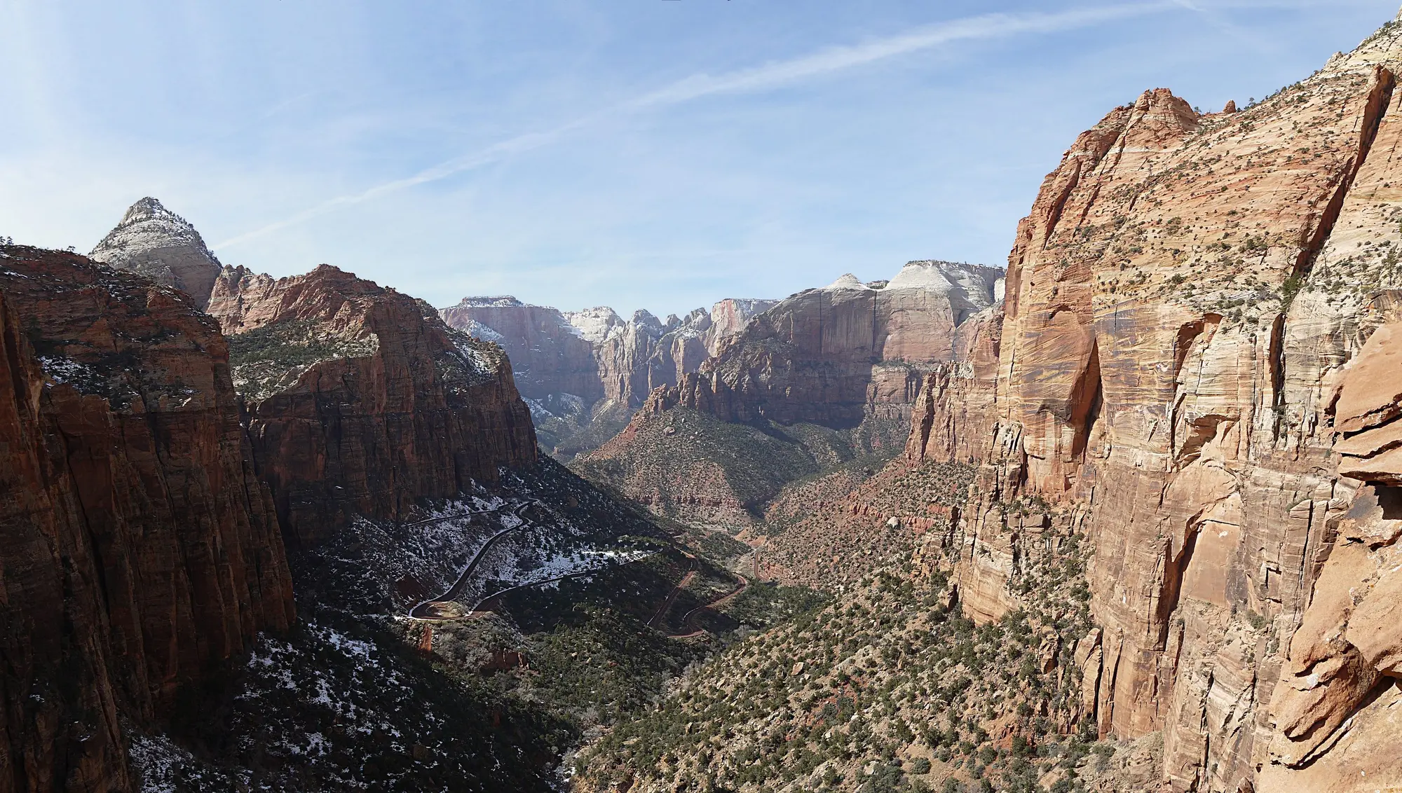
This is the road that links Zion Canyon to the east side, Bryce Canyon and Kanab: a 1.1-mile tunnel on a highway finished in 1930, climbing 900 feet in just under three miles of switchbacks, and the route every east-side hike and tour depends on. Nothing over 11 ft 4 in tall, 7 ft 10 in wide or 35 ft 9 in long may drive it, and no bicycle or pedestrian may ever enter the tunnel. Where to stay on the east side, and the drive on to Bryce, are on Zion and Bryce on one trip.
The closure, and the way around if it closes again
The Park Service’s alert, posted 30 September 2026, read: “The Zion-Mt. Carmel Highway is partially closed. There will be no through traffic until further notice. Zion Canyon Scenic Drive remains open to shuttles and lodge guests.” UDOT said the highway was closed in both directions “due to rockfall and debris”, and on 1 October that it “remains closed to through traffic until further notice.” The Park Service’s release of 9 October says a large rock formation collapsed onto the highway, damaging the roadway, and that it reopened the 7.5 miles from the East Entrance to Great Arch Overlook on 6 October, for scenic driving and day use, while crews cleared the rock. The whole highway reopened on Friday 9 October; UDOT posted it at 12:01 p.m. that day, and the closure is gone from the Park Service’s alert feed. The road’s standing alert is the one about large vehicles, below. The two that covered the last week of October, for the nightly construction closures and the paving’s one-way traffic, had come down by 1 November (under “Closures”, below).
UDOT’s alternative routes, if it closes again, go around the park to the south or the north. South is State Route 9 west to Hurricane, then State Route 59 through Hildale, Arizona 389 through Colorado City and Fredonia, and US-89A north to Kanab. North is I-15 to Highway 20 and over to US-89. UDOT adds that the mountain roads over the plateau, State Routes 14 and 143, may save time in a smaller vehicle for a driver comfortable with sharp curves and steep grades, and are not advised for RVs, trailers or oversized vehicles.
| From the Zion Canyon Visitor Center to | Through the tunnel | The way around, if it closes |
|---|---|---|
| Zion’s East Entrance | 11 mi, 30 min | 116 mi, 2 hr 45 min, by Hildale, Kanab and Mount Carmel Junction |
| Kanab | 42 mi, 1 hr 15 min | 86 mi, 2 hr, by Hildale and Fredonia |
| Bryce Canyon visitor center | 85 mi, 2 hr 10 min | 157 mi, 3 hr 35 min, by I-15 and Highway 20; 164 mi, 3 hr 45 min, by Kanab |
The distances and times are from OpenStreetMap’s car router (OSRM), run on 2 October 2026 and rounded up to the next five minutes, with no stops. For Bryce the two sources differ: the Park Service’s own figure for the Highway 20 route is roughly 150 miles and 2.5 hours, and the router says 157 miles and 3 hours 35 minutes. Plan on the longer.
The size limits, and what counts
These apply whenever the highway is open, and the Park Service’s large-vehicle alert is still posted.
From the Park Service’s large vehicles page, updated 2 September 2026:
| Single vehicle | Vehicle with a trailer | |
|---|---|---|
| Length | 35 ft 9 in | 50 ft overall, and no more than 26 ft from hitch to rear axle |
| Width | 7 ft 10 in | 7 ft 10 in |
| Height | 11 ft 4 in | 11 ft 4 in |
| Weight | 50,000 lb | 50,000 lb |
Measure with everything on. The park counts mirrors, tires, and attachments such as air-conditioning units, bike racks and satellite dishes. A camper van that is under the height limit can go over it with a roof box.
The whole stretch, not just the tunnel. The limits cover everything from Canyon Junction to the East Entrance, so a vehicle over them cannot reach Canyon Overlook, Checkerboard Mesa or the East Rim Trailhead from either direction.
Why. The Park Service cites safety studies from 1989 and 2019: longer vehicles cannot hold their lane on the switchbacks, wider or taller ones cannot pass through the tunnel in a single lane, and anything over 50,000 lb exceeds the limits of four bridges. The old escort system had also throttled the road: a 2016 study found traffic flowing freely through the tunnel for an average of 19 minutes an hour, and 8 on the busiest day.
One page has not caught up. The park’s commercial tours page, last updated 28 May 2026, still lists a $15 “Tunnel Traffic Control fee” for wide and tall vehicles. That is the escort-era rule. The large vehicles page, updated in September, is the current one: there is nothing to pay and no way through.
If you are over the limits
At the South or East Entrance you will be given instructions to turn around. Through the South Entrance an oversized vehicle is let in only to park in the large-vehicle lot by the Visitor Center if there is room, to reach Zion Lodge with a reservation, to camp at Watchman or South Campground, or to drive the Scenic Drive in the shuttle off-season. It may not go past Canyon Junction.
Two ways to still see the east side:
- Go around. The Park Service’s own detour figures: to Bryce Canyon by Highway 20, north of Cedar City, is about 150 miles and 2.5 hours — 63 miles longer but only about 42 minutes slower, because the state highways are much faster than this road, which usually runs under 30 mph. To the Grand Canyon’s North Rim by Highway 59 is about 128 miles and just over 3 hours, adding 23 miles and about 10 minutes; the rims, and what is open at each, are on the Grand Canyon page. To Moab the fastest way skips the tunnel altogether, by I-15 and I-70, about 345 miles; the routes are on the Moab page. While the highway was closed, from 30 September to 9 October, these were everyone’s routes; they remain the only ones for a vehicle over the limits.
- Leave it behind. The Zion Corridor Park & Ride at Zion White Bison Resort in Virgin takes large vehicles, with SunTran and the Zion White Bison shuttle running on to Springdale. The times are on the car-free page. From Springdale the east side still needs a car under the limits.
Closures: rockfall, construction and weather
Rockfall, 30 September to 9 October. The highway was closed to through traffic from Canyon Junction to the East Entrance from 30 September 2026 and reopened on 9 October; the detours are in the section above. Where the rock damaged the road the park laid gravel, and it set 26 to 30 October to repave it, with one-way traffic and minor delays east of Canyon Junction, at the first switchback. The Park Service had taken its paving alert down by 1 November; UDOT’s road-status page still carried the one-way-traffic notice that day, with no end date, beside the closure nights of 26 to 30 October. The Park Service’s current conditions and UDOT’s Zion area road status carry any new closure.
Overnight closures, from 26 October. UDOT’s fiber project closes the highway completely from 9 p.m. to 6 a.m. on its construction nights, while crews pull cable through the conduit inside the tunnel, between mileposts 36 and 39. The first week of them was set for Monday 26 to Friday morning 30 October, and its project page’s update of 30 October sets the second, Monday 2 to Friday morning 6 November. Its road-status page still listed only the first week on 1 November. The Park Service’s alert, “Zion Mount Carmel Highway — Nightly Road Closures”, covered only the first week and has come down, and the park had posted none for the second. While the road is closed, cars are turned around at Canyon Junction on the west side and about 50 feet before the tunnel’s east portal, and UDOT’s advice is to put the drive off until morning or go round by the routes above. These are the closures first set for late September and postponed on 24 September “due to material delays”, and UDOT says its schedules can still change with the weather, utility work and material delays.
Construction, into 2027. UDOT’s first phase, on SR-9 from Hurricane through the park, is due to finish in spring 2027, and its second, on US-89 north of Mount Carmel Junction and on Highway 20, in December 2026. Inside the park its crews work days and nights, Monday to Thursday except holidays, with traffic delays. Outside the park, its update of 30 October puts its Springdale crews on SR-9 at mileposts 30 to 32, along the southbound shoulder at the west end of town, and starts night work there as early as Monday 2 November, Monday night to Friday morning through the end of 2026, with one-way traffic and minor delays; its update of 23 October had set that night work at mileposts 28 to 30 from 26 October. Its crews at Rockville, mileposts 26 to 29, expect no traffic impacts. Its project page posts each week’s work.
Weather. The Park Service works to keep the highway open all year, and closes it for snow, ice, rockfall or traffic congestion. Check the alerts before a winter crossing.
Bikes, walkers and hitchhiking
No bicycles and no pedestrians in the tunnel, ever. The Park Service’s instruction to cyclists is to get a ride through, “which is often possible by hitchhiking”, and it states that rangers may not transport cyclists through the tunnel or arrange for it. The park’s rule on hitchhiking is that it is allowed only in established roadside pullouts, so wait in one on either side.
This matters most for e-bike riders: the Scenic Drive is open to bikes, but an e-bike cannot reach the east side under its own power. More on the biking page.
The East Entrance, and what is past it
The trailheads and pullouts below were cut off from Zion Canyon from 30 September to 9 October 2026. The park opened them again from the East Entrance side first: on 6 October, three days before through traffic, it reopened the 7.5 miles from the East Entrance to Great Arch Overlook for scenic driving and day use. If the road closes again, ask the park on 435-772-3256 whether that end is open before driving round for it.
Where it is. The East Entrance is 13 miles west of Mount Carmel Junction on State Route 9. The park is open 24 hours a day, and when the highway is open you pay the entrance fee here even if you are only driving through to Springdale — the Park Service is explicit that passing through counts. It is $35 a car for seven days, plus $100 for each non-US resident aged 16 or over unless someone in the car holds an annual pass; the fee page has every case. Card is preferred and cash is accepted.
Parking. East of Canyon Junction you park in the paved lots at trailheads and viewpoints and in the designated pullouts along the highway, as space allows. Many pullouts fit only a normal-size car. There is no water at the east side trailheads; pit toilets are along the highway.
Canyon Overlook is the one-mile hike everyone stops for, just past the tunnel’s east portal. Its lot is tiny and fills early. The details are on the Canyon Overlook page.
The East Rim Trail starts 100 feet west of the East Entrance fee booths: 5.9 miles one way and about 1,000 feet of climbing to Stave Spring, about six hours there and back. Since a major rockfall it no longer connects down to Zion Canyon at Weeping Rock. For Observation Point, the shorter route is from the East Mesa Trailhead; see the Observation Point page.
Outside the park, the country east of the entrance is where the UTV, jeep and slot-canyon trips run, because off-road vehicles and guided canyoneering are not allowed inside Zion. That country is reached from Mount Carmel Junction; from Springdale it is through the tunnel when the highway is open, and the long way round by Kanab when it is not. The outfitters and what each ride includes are on the East Zion UTV and jeep page.
Further east, US-89 runs on from Mount Carmel Junction through Kanab to Page, Arizona, and Antelope Canyon, about 120 miles from Zion Canyon through the tunnel. Every visit to the canyon is a guided Navajo tour, on Arizona time; the tours and the clock are on the Antelope Canyon page.