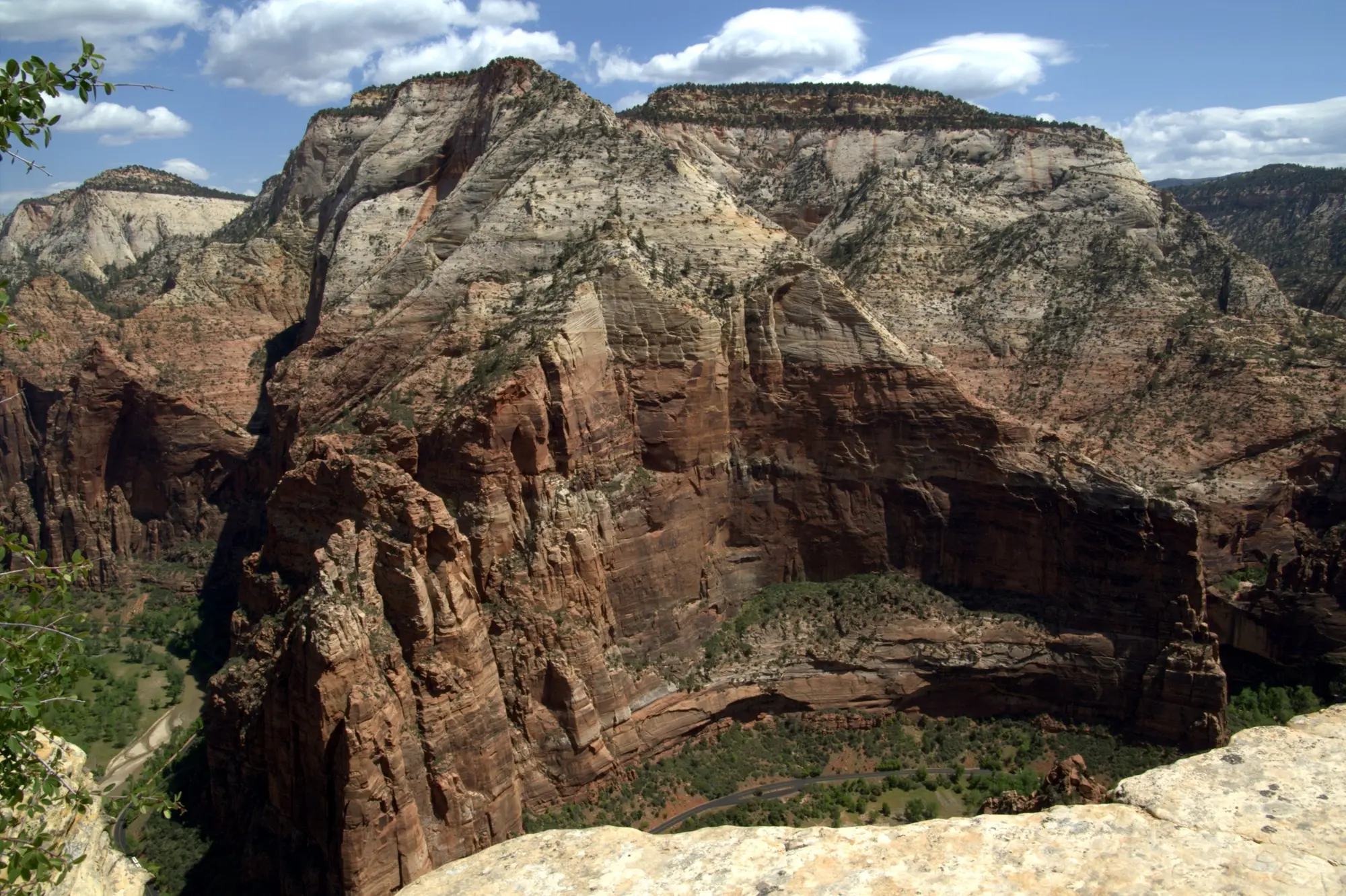
Observation Point in Zion seen from the summit of Angels Landing, a broad sandstone rim above the canyon with the switchbacks of the trail that climbs to it visible on the right

Observation Point via East Mesa: 6.8 miles, no permit

Photo: Aneta Kaluzna · CC BY-SA 2.5

Checked

A higher view than Angels Landing, no permit, and no chains. The old route is closed and most sites still say the hike is — it is not.

2 trips · from $70.32 · See them
Distance
6.8 miles round trip
Elevation gain
300 ft
Time
3-5 hours
Difficulty
Moderate

No permit

Getting there
Drive to the trailhead
Water
Dry trail
Sun
Mixed sun and shade
With kids
Crowds
Trailhead
Google Maps · Apple Maps
Best time
Late spring to fall, and only when the access road is dry. The Park Service calls these dirt roads impassable at times in winter and spring

Observation Point is 700 feet higher than Angels Landing and looks down on it. It needs no permit, has no chains, and most of the walking is flat.

It is also the trail that the internet is most confidently wrong about.

The closure that is not the closure

Search for this hike and you will find major sites labeling it CLOSED.

What is closed is the East Rim Trail from Weeping Rock, wrecked by a rockfall in 2019 and shut ever since, along with Hidden Canyon. That was the classic route — eight miles and 2,100 feet up from the canyon floor — and it is gone for the foreseeable future.

The viewpoint is open. It is reached from the other side, by the East Mesa Trail, which starts outside the park on the high ground above the canyon. You walk in nearly level through ponderosa forest and arrive at the top of the cliff.

The practical effect: what used to be a brutal climb is now a moderate walk, and a lot of people never find out because a page from 2019 told them it was closed.

The trade-off

The hike got easier. The logistics got harder.

There is no shuttle stop. You drive — out of Springdale, east through the tunnel on Highway 9, then onto North Fork Road, which turns to dirt. Allow about an hour each way.

The tunnel road is open again. The Zion-Mount Carmel Highway was closed to through traffic from Canyon Junction to the East Entrance from 30 September 2026 after a rockfall, and reopened on 9 October. North Fork Road leaves Highway 9 east of the park, so the trailhead is reached from Mount Carmel Junction. If the highway closes again, the drive from Springdale to the turn alone is 114 miles and about 2 hours 40 minutes by Hurricane, Hildale, Kanab and the junction, by OpenStreetMap’s car router, before the dirt, and the answer is to stay on the east side for this one.

That road is the catch, and we understated it until 18 September 2026. The Park Service says the East Rim trailheads are “only accessible by high-clearance / 4-wheel-drive dirt roads”, which are often impassable in winter and spring and after rain.

Do not take an ordinary rental sedan up here. The park’s wording is that the roads can be “extremely muddy and inaccessible in the winter, spring, and after rainstorms”, and there is no shuttle to rescue you. Go late spring to fall, in something with clearance, and only when it is dry — if it has rained, take the loss and hike something else.

Park only in the marked spaces. The land around the East Mesa trailhead is private, the Park Service asks visitors to respect it, and it says plainly that illegally parked vehicles may be cited or towed at the owner’s expense.

This is also why it stays quiet. Everything that makes it inconvenient — the drive, the dirt, the fact that it is not on the shuttle map — is what keeps the crowds in the canyon.

Who this is actually for

Anyone who lost the Angels Landing lottery. You get a higher view, from a trail with no permit, no lottery, and no exposure. The thing you miss is the chains, and for a good number of people the chains were never the appeal.

Anyone who does not like drop-offs. The path is wide and the edge at the top is a place you choose to walk to rather than one you must traverse.

Anyone tired of the shuttle. Being outside the system means your day is not shaped by a line at stop 1. The same east side is where the UTV, jeep and slot-canyon trips run; they are compared on the East Zion UTV and jeep page, and the horse ride to the slot canyon at Red Hollow is on the horseback page.

Rather go with a guide?

Ranked by what we'd book. No operator paid to be here.

We earn a commission if you book through these links. How we make money

Award Winning UTV Slot Canyon Tour

Run by ROAM - East Zion

  • Departs east Zion
  • 2 hours
  • Free cancellation to 24 hrs before

Outside the park, so outside the permit lottery and the shuttle line entirely. A guided Can Am UTV ride out to the canyons and then in on foot: the guides drive, and despite the wording in the booking link nobody rappels.

from $104 / personprice checked Oct 13

Rated 5.0 out of 5 from 1,745 reviews on Viator

Check dates on Viator (opens in a new tab)

Small-Group East Zion White Mountain Horseback Ride

Run by East Zion Adventures

  • Departs east Zion
  • 1 hour
  • Free cancellation to 24 hrs before

No date is on sale from 7 to 20 January 2027, or from 14 March to 28 April 2027.

A small-group ride on the east side, outside the park - no shuttle and no permit. Beginners get a short lesson at the stables, then ride about 25 minutes to the mouth of the slot canyon at Red Hollow and walk on up it. From age 8, with a strict 220-pound weight limit.

from $70.32 / personprice checked Oct 27

Rated 4.9 out of 5 from 326 reviews on Viator

Check dates on Viator (opens in a new tab)

Quick answers

Is Observation Point closed?

No, but the popular route to it is. The East Rim Trail from Weeping Rock has been closed since a rockfall in 2019 and remains closed, along with Hidden Canyon. Observation Point itself is open and reached by the East Mesa Trail, which starts outside the park. Several large hiking sites still label the whole thing closed, which is wrong.

Is Observation Point better than Angels Landing?

It is higher, it looks down on Angels Landing, it needs no permit and it has no chain section. If the view is what you want, it is the better hike. If the chains are what you want, nothing substitutes.

How do you get to the East Mesa trailhead?

You drive, and you need the right vehicle. It is reached by North Fork Road off Highway 9 east of the park, and the Park Service describes the East Mesa trailhead as accessible only by high-clearance or four-wheel-drive dirt roads, extremely muddy and often impassable in winter, in spring and after rain. An ordinary rental sedan will not do it. Allow about an hour from Springdale through the tunnel — and when the Zion-Mount Carmel Highway is closed to through traffic, as it was from 30 September to 9 October 2026 after a rockfall, about three hours the long way round by Hurricane, Hildale, Kanab and Mount Carmel Junction. Park only in the designated spaces — the land around the trailhead is private and illegally parked vehicles are cited or towed — and expect no shuttle and no public transport of any kind.

Do you need a permit for Observation Point?

No. Neither the East Mesa Trail nor the viewpoint requires a permit, which is much of why it is the sensible answer for people who did not win the Angels Landing lottery.

Photo credits