Zion’s most famous hikes are in the bottom of narrow canyons with a river in them. That is the appeal and it is also the hazard, and the Park Service is unusually clear about the second part.
The four ratings, and what they actually mean
The park publishes a flash flood potential rating. Here is what each tier means, in its own words:
| Rating | Definition |
|---|---|
| NOT EXPECTED | “Flash flooding is not expected. Your safety is your responsibility.” |
| POSSIBLE | “Some slot canyons, dry washes, and small streams may experience flash flooding.” |
| PROBABLE | “Some slot canyons, dry washes, and small streams are expected to experience flash flooding.” |
| EXPECTED | “Many slot canyons, dry washes, and small streams are expected to experience flash flooding.” |
And the sentence that tells you how to read them:
“‘Possible,’ ‘probable,’ and ‘expected’ flash flood potential ratings should be a serious cause for concern.”
All three. Not just the top one. “Possible” is not the reassuring end of the scale — it is the bottom of the concerning end, and the only genuinely calm rating is “Not Expected.”
The 30 percent thing
This is the most useful paragraph the Park Service has ever published about weather, and almost nobody knows it:
“When the National Weather Service states that there is a ‘30 percent chance of rain,’ they are not stating that there is a 30 percent chance that it will rain. They are stating that 30 percent of the forecast area will be affected by measurable precipitation.”
Read that again if it did not land. A 30 percent chance of rain does not mean probably dry. It means it is going to rain on roughly a third of southern Utah, and the only open question is which third.
In a landscape where a storm twenty miles upstream fills the canyon you are standing in, “30 percent” is not a reason to go.
Three sentences to take seriously
“There is never a ‘0% chance’ of flooding.”
“Flash floods can happen even with sunny skies overhead.”
“You can’t outrun a flash flood.”
And the scale of the thing:
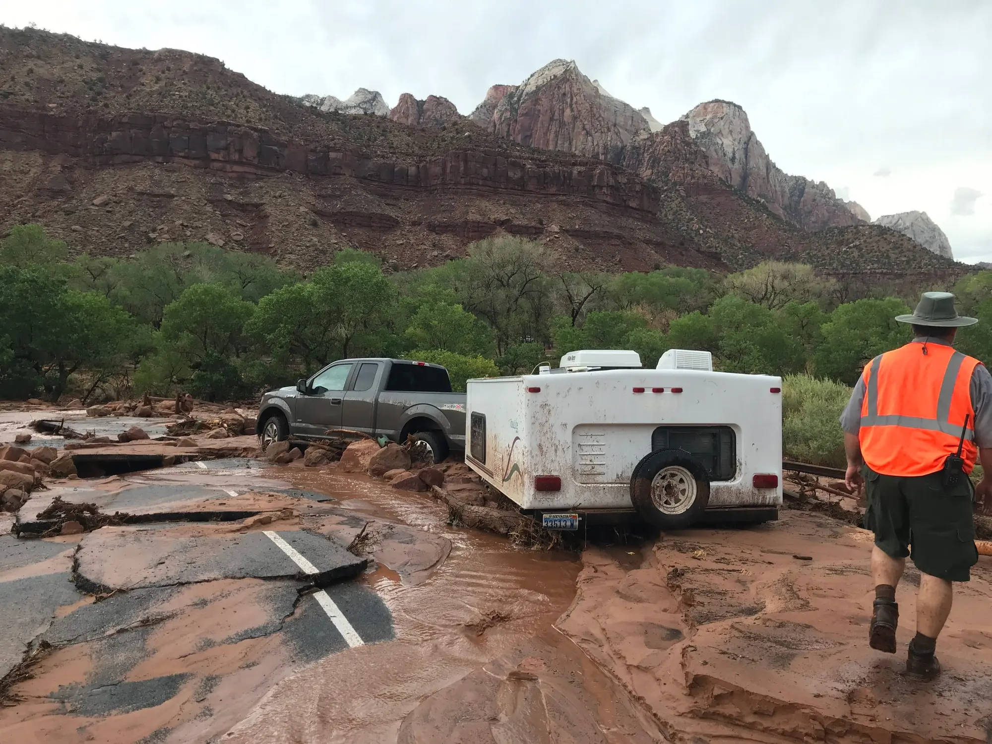
In a flash flood the water rises in minutes, sometimes seconds, and the Park Service describes a wall of water and debris 12 feet high or more coming down the canyon.
Twelve feet. In a slot canyon with walls you cannot climb.
The depths that matter are much smaller than people assume:
- 6 inches — enough to knock a person off their feet, and to cause loss of vehicle control
- 12 to 24 inches — enough to pick up a vehicle and carry it off
And how it kills, which is not what most people picture:
“death most often occurs by blunt force trauma from rocks/debris in the water.”
It is not drowning. It is being hit by what the water is carrying.
The warning signs, as a checklist
Worth memorizing before you are standing in a canyon deciding:
- Any deterioration in weather conditions
- Buildup of clouds or sounds of thunder
- Sudden changes in water clarity from clear to muddy
- Floating debris
- Rising water levels or stronger currents
- Increasing roar of water upstream
The water-clarity one is the signal people miss, because it arrives before the noise and before the rise.
What to do
The Park Service’s instruction is to reach higher ground as fast as you can, without stopping for gear or tents, and to expect it to take hours for the water to drop to safe levels. Leave the bag. Go up. And then expect to be up there a while — this is not a wave that passes in five minutes.
The automatic closures
The park does not rely on your judgment alone:
“The Narrows also closes when a Flash Flood Warning is issued by the National Weather Service. The Narrows will remain closed for at least two hours after a warning is lifted.”
“The river and all canyons in the park close when the National Weather Service issues a Flash Flood Warning.”
Plus the flow thresholds, which are two different numbers for two different trips:
| Closes above | |
|---|---|
| All Narrows hiking | 150 CFS |
| Top-down route, including all overnight trips | 120 CFS |
Detail on that split is on the top-down page, and it catches people who checked the number everyone quotes.
When this is a live concern
Monsoon season runs July to September: more moisture in the air and summer heat build strong afternoon thunderstorms. But the Narrows also closes in spring for a completely different reason — snowmelt — and the park publishes the history, which is a better planning tool than any average:
| Year | Spring closure |
|---|---|
| 2016 | 3 Apr – 22 May |
| 2017 | 11 Mar – 21 May |
| 2018 | Open most of the time |
| 2019 | 6 Apr – 22 Jun |
| 2020 | 9 Apr – 18 May |
| 2021 | Open most of the time |
| 2022 | Open most of the time |
| 2023 | 8 Apr – 19 Jun |
| 2024 | 11 Apr – 19 May |
| 2025 | Open most of the time |
| 2026 | Open most of the time |
Six of the last eleven springs had a closure, the other five were open most of the time, and two closures ran into late June. “Open most of the time” is the park’s wording: its table marks a closure only where the river stayed above 150 CFS most of the time. A May trip built entirely around the Narrows is a coin flip, and that is worth knowing at the booking stage rather than the trailhead.
Where to check, on the day
Three primary sources, in order of usefulness:
- The park’s current conditions page — carries the day’s flash flood potential rating and the park’s alerts, including trail and road closures
- The National Weather Service flash flood forecast for southern Utah
- USGS river flow for the North Fork of the Virgin River — the live CFS number the thresholds above refer to
Check them the morning of, not the night before. The rating changes.
What a guide changes, and what it does not
A guide does not make a canyon safe. What a guide does is make the cancellation decision somebody else’s job — someone who reads this forecast every day and knows what the river looked like last week, rather than a visitor who has one day and a long drive behind them. Plenty of people drive four hours, see “possible,” and go anyway because they came a long way.
That difference is real, and it is not a safety guarantee, which nobody can sell you. The guided Narrows days we list are on the Narrows page, along with the gear you rent to go on your own.