
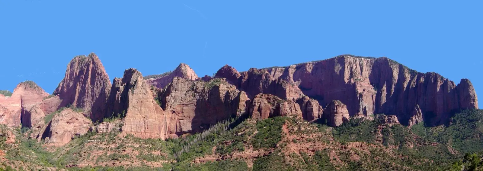

Zion is nearly 150,000 acres and almost everybody sees the same six miles of it. Kolob Canyons is the other entrance, 40 miles north, and the reason to go is simply that nobody else does.
Is Kolob Canyons open?
Yes: the road, the visitor center and all three trails are open. As the Park Service states it on 13 October 2026:
| Status | |
|---|---|
| Kolob Canyons Road | Open. No closure is posted; the Park Service says the road is open most of the year and closes often in winter for snow or ice |
| Kolob Canyons Visitor Center | Open 8 a.m. to noon and 1 to 5 p.m., closed for lunch |
| Wilderness Desk | Closed until further notice; permits come from the Zion Canyon Visitor Center |
| Timber Creek Overlook Trail | Open; no closure is posted |
| Taylor Creek Trail | Open; the flood closure of 11 October 2026 was lifted on 13 October |
| La Verkin Creek Trail to Kolob Arch | Open; no closure is posted |
The park itself is open 24 hours a day, every day of the year. A closure is posted at the top of the Park Service’s Current Conditions page, which is worth a look on the morning you drive up, especially from November on.
Where it is, and what it is
Kolob Canyons is at Exit 40 on Interstate 15, 40 miles north of Zion Canyon and 17 miles south of Cedar City. From the visitor center, the Kolob Canyons Road runs five miles up into the district, with the trailheads and viewpoints along it. What you are looking at is a set of narrow, parallel box canyons cut into the western edge of the Colorado Plateau, with cliff walls of 2,000 feet. Those are the “fingers” of the Kolob, and the road that looks into them is the one Utah’s tourism office calls the Kolob Fingers Road Scenic Byway: the Kolob Fingers Road and the Kolob Canyons Road are the same five miles.
Kolob Canyons elevation
Kolob Canyons sits well above Zion Canyon, which is part of why its road closes for snow and ice in winter. Heights from the US Geological Survey’s elevation data, read at each point and rounded:
| Point | Elevation |
|---|---|
| Zion Canyon Visitor Center, for comparison | about 3,930 ft |
| Kolob Canyons Visitor Center, Exit 40 | about 5,080 ft |
| Taylor Creek Trailhead | about 5,500 ft |
| Double Arch Alcove, end of the Taylor Creek Trail | about 5,960 ft |
| Lee Pass, start of the La Verkin Creek Trail | about 6,080 ft |
| End of the road, Timber Creek Overlook Trailhead | about 6,240 ft |
| Timber Creek Overlook, the high point of the trail | about 6,360 ft |
| Horse Ranch Mountain, the park’s highest point | 8,726 ft, by the Park Service’s figure |
So the road climbs nearly 1,200 feet in its five miles, and the end of it is more than 2,300 feet higher than the Zion Canyon Visitor Center. Expect it to be cooler than Zion Canyon on the same day.
There are over 20 miles of hiking trails in this district. For scale, the whole park has over 90 miles.
The five things that decide whether this works
1. You must stop at the visitor center.
Every visitor has to stop at the Kolob Canyons Visitor Center to show a pass or pay the Zion entrance fee. Not a suggestion and not a self-pay envelope. If you already have a pass this is thirty seconds; if you do not, this is where you buy one.
2. The visitor center closes for lunch. Its published hours are “Open 8 am — 12 pm / Closed 12 pm — 1 pm / Open 1 pm — 5 pm.” Arriving at 12:15 with no pass means waiting until one o’clock to get in.
3. No Wilderness permits are issued here.
Every Wilderness permit comes from the Zion Canyon Visitor Center. The Kolob Canyons Wilderness Desk is listed as closed until further notice. So if your plan involves a permit — the Subway, the Narrows top-down, a backpacking night — the permit comes from the main canyon, 40 miles away, in person.
4. The road closes for snow, and you cannot walk it.
The Kolob Canyons Road may close in winter for snow or ice, and walking the road while it is being plowed is prohibited — so a closed road means no access at all, not a walk in.
5. Parking is limited. The trailheads have small designated lots, and the Park Service’s advice is to arrive early and have a backup plan. Fewer people, but also far fewer spaces.
A group rule that exists nowhere else in Zion
Groups of more than 12 people traveling together may hike only one trail here: Timber Creek Overlook. If you are thirteen or more people traveling together, you have exactly one trail in this district. Worth knowing before a family reunion drives an hour north.
Facilities, such as they are
There are pit toilets at the Taylor Creek Trailhead, the South Fork parking lot and the Kolob Canyons Viewpoint. Accessible vault toilets and accessible parking exist at the Visitor Center, Taylor Creek Trailhead, South Fork Picnic Area and Timber Creek Overlook Trailhead. There is no food, no gas, and no lodge.
The name confusion, which is genuinely expensive
Kolob Canyons and Kolob Terrace Road are different places and people mix them up in a way that costs an entire morning.
| Kolob Canyons | Kolob Terrace Road | |
|---|---|---|
| Reached from | Exit 40 on I-15 | The town of Virgin |
| Distance from Visitor Center | 40 miles north | 13.5 miles west to the start of the road |
| What is there | Five-mile scenic drive, box canyons, Timber Creek | Lava Point, the Subway trailheads |
If you are going to the Subway or Lava Point, you want Kolob Terrace Road from Virgin — not Exit 40. Getting that wrong is an eighty-mile mistake.
Kolob Creek is neither. It is on the Kolob Terrace, north and east of Lava Point, and it runs southeast to the North Fork of the Virgin River, which it joins in the upper Narrows just below Deep Creek, inside the park. Its canyon is a technical descent with rappels, and the Park Service requires a canyoneering permit for every canyon in Zion that calls for ropes; the rules are on the slot canyon page. Nothing about Kolob Creek starts at Exit 40.
No shuttle, anywhere out here
The shuttle system covers Zion Canyon only. The Kolob Canyons road, Kolob Terrace Road and the Zion-Mount Carmel Highway all take private cars year-round, which cuts both ways. You drive your own car on a road with no shuttle restriction — no reservations, no shuttle line, no 7 a.m. scramble — and there is no way to get here without one. “Year-round” means no shuttle rule, not no closures: the Park Service says the Kolob Canyons Road closes frequently in winter, and a rockfall closed the Zion-Mount Carmel Highway to through traffic from Canyon Junction to the East Entrance from 30 September to 9 October 2026 — the tunnel page has the current state. Kolob Canyons, off I-15, is not affected. This is the district that makes the case for renting a car on its own.
The three trails
| Trail | Distance | Climb | Time | What it is |
|---|---|---|---|---|
| Timber Creek Overlook | 0.6 mi each way | 117 ft | About an hour | A rocky ridge to a view of Timber Creek, the Kolob Terrace and the Pine Valley Mountains. The only trail here open to groups over 12 |
| Taylor Creek | 2.6 mi each way | 799 ft | 3 to 4 hours | Up the Middle Fork of Taylor Creek, past two 1930s homestead cabins, to the Double Arch Alcove. Wilderness, so 12 people maximum |
| Kolob Arch via La Verkin Creek | 14 mi round trip | 1,037 ft of elevation change | 7 to 9 hours | From Lee Pass down to La Verkin Creek; a spur at about seven miles leads to a view of Kolob Arch, 287 feet across |
Distances and climbs are from the Park Service’s trail surveys and trail pages. The climbing figures for Timber Creek and Taylor Creek count every rise along the way, which is why they run higher than the net figures in the park’s printed hiking guide (100 and 450 feet).
Taylor Creek Trail is open again. The Park Service closed it because of flooding on 11 October 2026 and lifted the closure on 13 October. A storm can close it again, so check the Park Service’s Current Conditions page before you drive up.
Timber Creek Overlook is the one to do if you have an hour: short, easy, and on a clear day the horizon reaches Mount Trumbull on the Grand Canyon’s north rim, 100 miles away. Taylor Creek is the half-day hike, with creek crossings that wet your feet in spring and ice in winter. Kolob Arch is a full day in Zion Wilderness and a serious one; carry all the water you need, because the creeks carry the same cyanobacteria warning as the rest of the park.
Should you go
Yes, if you have a car, half a day, and the main canyon has worn you out. The drive alone is worth it, and Timber Creek Overlook is a short walk to a very big view.
No, if your time is tight. Two hours of driving to see a different part of a park you have not finished seeing is a poor trade on a three-day trip.
Definitely not, if you need a Wilderness permit today, or you are a group of more than twelve wanting a choice of trails.
From the air, instead. Kolob’s finger canyons are what the scenic flights nearby make the most of: Color Country Air Adventures flies a Kolob Canyons tour of 30 to 40 minutes from Hurricane, and Zion Helicopters’ longer routes from Virgin take them in. Routes, minutes and prices are on the helicopter and scenic flights page.


